
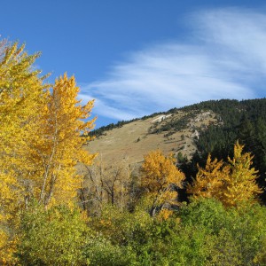
 Bozeman has an award-winning urban trail system that will eventually form a pathway across the valley from the southern mountains to the “M” in the Bridger Mountains in the north. A map of the trail system can be obtained from Bozeman City Parks and Recreation (located in Beall Park – 409 N. Bozeman Ave.). Some of the favorite trails are the Gallagator Trail which begins near the Museum of the Rockies and heads toward downtown, ending at Lindley Park. Just across the street from Bogert Park (at the corner of Church and Story Streets), another popular trail takes you up onto Peet’s Hill and follows a ridgeline to the blue water tower; a great walk to take at sunset or for a beautiful view of the city. With a map and a bit of exploration, you will find a wide variety of options for trail walking or biking.
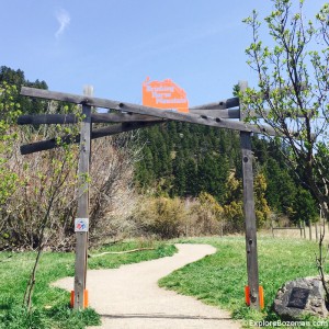
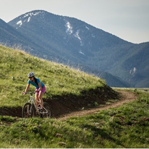
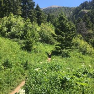
Bozeman has over 80 miles of trails in the city that are a part of the trail system Main Street to the Mountains. There are trails that wind through neighborhoods in Bozeman great for running and biking, trails across ridgelines and trails that connect up to the mountain trail systems. The Gallatin Valley Land Trust and many volunteers have worked hard to expand and maintain these trails. Tonight I am going to go on a short hike using one of these trails, the Triple Tree Trail, this trail starts in town and then winds its way into the national forest to a nice lookout over the valley. It is great to get done with work at 5 and within a few minutes be on the trails and enjoying the nature around Bozeman.
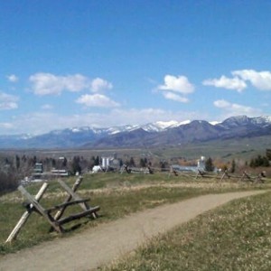
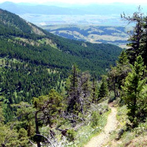
There are many great trails outside of Bozeman as well. Hyalite Canyon just a 20 minute drive offers great hiking and camping in the summer and ice climbing and xc skiing in the winter. In addition we are surrounded by several mountain ranges giving you plenty of opportunities to get out in the mountains. Probably the most popular hike in town is to the “M” . The “M” was created by MSU students in 1915 and is maintained by MSU students today who go up each year to repaint the rocks that creat the large “M” on the side of Mount Baldy overlooking Bozeman and the MSU campus. To get to this trailhead is only a short 10 minute drive from campus and several routes lead up to it. Once you reach the base of the “M” you have great views of Bozeman and the Gallatin Valley.
Click to view an Interactive Map of Bozeman’s Hiking Trails.
Trails in Bozeman
Thanks to Bozeman’s Main Street to the Mountains trail system, you don’t have to go far to escape knee-pounding pavement and spend some time in nature. Try the trails below or explore your own.
M Trail
Rated: [usr 5]
Difficulty: [ms_label background_color=”#1e73be” ]MODERATE[/ms_label]
 M Trail is a 1.7 mile moderately trafficked loop trail. The Montana State University “M” is located at the mouth of Bridger Canyon on the south flanks of Baldy Mountain. The trail’s namesake “M” was created by MSU students in 1915. The 250-foot whitewashed rock “M” has three trails to access it. The right fork follows the ridge for a short and steep hike. The left fork switchbacks through a fir and juniper forest, making a more gradual ascent. The left fork is the beginning of the Bridger Mountains National Recreation Trail, a 21-mile ridge route following the contours of the Bridger Range to Fairy Lake. This hike to the “M” climbs up the steeper ridge route and descends through the forest via the switchbacks. EXPLORE M TRAIL
Drinking Horse Mountain
Rated: [usr 5]
Difficulty: [ms_label background_color=”#1e73be” ]MODERATE[/ms_label]
 Drinking Horse Trail is a 2.2 mile moderately trafficked loop trail. The Drink Horse Mountain trail is quickly becoming one of the most popular trails in the Gallatin Valley. Climbing 700 feet from Bridger Creek to the 5,522 foot summit of Drinking Horse Mountain, the figure-eight loop trail offers scenic vistas in the Bozeman area and surrounding mountain ranges. There are two trails(one steeper, the other easier) that make a 3.5 mile loop. EXPLORE DRINKING HORSE TRAIL
Peets Hill
Rated: [usr 4]
Difficulty: [ms_label background_color=”#81d742″ ] EASY [/ms_label]
 Peets Hill is not only a popular spot to gaze out over the valley, but offers sledding in the winter and picture-perfect sunsets year-round. Peets Hill also makes a great jumping-off point, as it connects to the Gallagator, Sourdough, and Highland Glen trails. EXPLORE PEETS HILL
The Gallagator Trail
Rated: [usr 4]
Difficulty: [ms_label background_color=”#81d742″ ] EASY [/ms_label]
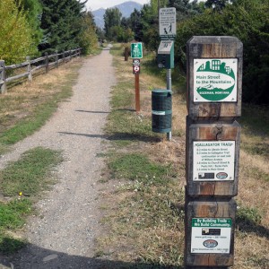 Gallagator Trail is a 2.2 mile out and back trail. The Gallagator Trail connects Main Street to the south end of town at Sacajawea Middle School. It skirts Langhor, Lindley, and Burke parks, while also bypassing Peets Hill. The Gallagator Trail can be accessed easily at the intersection near Burke Park or on the east side of the Bozeman Public Library. EXPLORE GALLAGATOR TRAIL
Hyalite Creek Trail
Rated: [usr 5]
Difficulty: [ms_label background_color=”#dd3333″ ] HARD [/ms_label]
Hyalite Creek Trail to Hyalite Lake is a 5.5 mile heavily trafficked out and back trail. Elevation gain 250 feet to 1900 feet if you go to Hyalite Lake. The trail is considered the most spectacular hike in the Bozeman area. The trail passes eleven waterfalls in a deep canyon with massive cliff walls and majestic peaks. EXPLORE HYALITE CREEK TRAIL
Sourdough Trail
Rated: [usr 5]
Difficulty: [ms_label background_color=”#81d742″ ] EASY [/ms_label]
 Sourdough Creek Nature Trail is a 4.3 mile loop trail. The trail is a system all in itself. With many spurs, loops, and winding turns, you could get lost here—if it weren’t for Bozeman Creek running alongside. Although the northern trailhead can be somewhat difficult to find (off Spring Creek Dr.), the southern access point off Goldenstein provides parking and is easy to locate. EXPLORE SOURDOUGH TRAIL
Highland Glen Nature Preserve
Rated: [usr 4]
Difficulty: [ms_label background_color=”#81d742″ ] EASY [/ms_label]
 The latest addition to Bozeman’s trail system, Highland Glen Nature Preserve trails offer singletrack for bikers and runners alike. It has three access points: at the sports complex by the hospital, at the end of Maple Dr., and at the Painted Hills parking area. These trails are groomed in winter for cross-country skiing. EXPLORE HIGHLAND GLEN TRAIL
Sypes Canyon Trail
Rated: [usr 4]
Difficulty: [ms_label background_color=”#1e73be” ]MODERATE[/ms_label]
 Sypes Canyon is a 6.2 mile lightly trafficked out and back trail. The trail follows Sypes Creek for most of the hike. At the saddle, head right up a small hill to the overlook where you can see Bozeman, and the Gallatin, Madison, and Tobacco Root ranges. The Sypes Canyon Trail can be joined for a loop with Bridger Foothills Trail, Truman Gulch, The College M Trail, or Middle Cottonwood. EXPLORE SYPES CANYON TRAIL
Middle Cottonwood Creek
Rated: [usr 4]
Difficulty: [ms_label background_color=”#1e73be” ]MODERATE[/ms_label]
 Middle Cottonwood Creek is a 5.1 mile heavily trafficked out and back trail. The trail initially is a rather slight incline and makes for a nice hike along Middle Cottonwood Creek. The trail is well marked along the lower portions and would be difficult to miss. There is one foot bridge early on along this hike. EXPLORE MIDDLE COTTONWOOD TRAIL
Palisade Falls
Rated: [usr 5]
Difficulty: [ms_label background_color=”#81d742″ ] EASY [/ms_label]
Palisade Falls is a 1 mile heavily trafficked out and back trail that leads to a beautiful 80-foot waterfall. The asphalt-coated trail is perfect for child strollers. Palisades Falls is the result of prehistoric lava flow forming massive hexagonal basalt columns.
Grotto Falls
Rated: [usr 4.5]
Difficulty: [ms_label background_color=”#81d742″ ] EASY [/ms_label]
Grotto Falls Trail is a 2.4 mile out and back trail. The elevation gain is only 250 feet. This is a great trail to hike if you’re new to hiking in Montana.
Emerald Lake
Rated: [usr 4.5]
Difficulty: [ms_label background_color=”#1e73be” ]MODERATE[/ms_label]
Emerald and Heather Lakes Trail is a 7.3 mile moderately trafficked out and back trail. You can continue beyond Emerald Lake to Heather lake for an additional mile. Emerald Lake sits in a dramatic cirque made of Mount Chisholm and Overlook Mountain.
East Gallatin River Trail & Glen Lake (Bozeman Beach)
Rated: [usr 5]
Difficulty: [ms_label background_color=”#81d742″ ] EASY [/ms_label]
East Gallatin River Trail & Glen Lake (Bozeman Beach) is a 1.2 mile out and back trail. The East Gallatin River Trail begins at Bozeman Beach and Glen Lake, a man-made lake with a 300-foot beachfront in the East Gallatin Recreation Area. The recreation area has picnic shelters and a fishing dock. The trail leaves the lake and follows the East Gallatin River. There are various fishing accesses along the route.
Storm Castle
Rated: [usr 4.5]
Difficulty: [ms_label background_color=”#1e73be” ]MODERATE[/ms_label]
Storm Castle Peak is a 4.7 mile moderately trafficked out and back trail. Storm Castle Peak is a rocky peak that rises 7,170 feet atop the east wall of the Gallatin Canyon. The trail gains 2,300 feet in 3 miles.
Bozeman Creek Trail
Rated: [usr 4]
Difficulty: [ms_label background_color=”#81d742″ ] EASY [/ms_label]
Bozeman Creek Trail is a 16 mile out and back trail. The trail offers hiking and mountain biking opportunities in summer months and cross-country skiing in the winter. In the winter the the Bozeman Creek trail section is groomed regularly by the Bridger Ski Foundation Nordic Team.
Pine Creek Lake Trail
Rated: [usr 5]
Difficulty: [ms_label background_color=”#1e73be” ]MODERATE[/ms_label]
Pine Creek Lake is a 4.1 mile moderately trafficked point-to-point trail located near Livingston, MT that offers scenic views and is rated as moderate. The trail is well defined and meanders through forest en route to the base of Pine Creek Falls. The trail becomes strenuous continuing past a series of waterfalls and smaller lakes before reaching Pine Creek Lake.
Lava Lake Trail
Rated: [usr 4.5]
Difficulty: [ms_label background_color=”#1e73be” ]MODERATE[/ms_label]
The Lava Lake (Cascade Creek) trail is a 6 mile, moderately rated, out and back trail that climbs 1600 ft to a beautiful lake setting that is surrounded by the Spanish Peaks. Located 30 min south of Bozeman, MT, the trail is primarily used for hiking and is easily accessible from May until Oct.
Triple Tree Trail
Rated: [usr 4]
Difficulty: [ms_label background_color=”#81d742″ ] EASY [/ms_label]
Triple Tree Trail is a 4.3 mile moderately trafficked loop trail located near Bozeman, MT that features beautiful wild flowers and is good for all skill levels. The trail offers a number of activity options and is accessible from May until October.
Chestnut Mountain Trail
Rated: [usr 4.5]
Difficulty: [ms_label background_color=”#1e73be” ]MODERATE[/ms_label]
Chestnut Mountain to Frog Rock Trail is a 13.8 mile lightly trafficked out and back trail. This easily accessible trail provides great hiking, mountain biking and rock climbing opportunities. Chestnut Mountain Trail climbs 2200 feet in 4.6 miles past the spectacular Frog Rock pinnacles to the ridge of Chestnut Mountain.
Story Mill Spur Trail
Rated: [usr 3]
Difficulty: [ms_label background_color=”#81d742″ ] EASY [/ms_label]
The Story Mill Spur Trail is an interpretive trail along the railroad right-of-way. The trail crosses Rocky Creek, where benches have been placed in the shade of the cottonwood trees. The hike passes the Bozeman Livestock stockyards and the historic Story Mill to Bridger Canyon
Story Hills Trail
Rated: [usr 4]
Difficulty: [ms_label background_color=”#1e73be” ]MODERATE[/ms_label]
The Story Hills Trail is on privately owned property and is open for recreation to the public during daylight hours. The trail offers great views of the Gallatin Valley all along the trail.
South Cottonwood Creek Trail
Rated: [usr 4]
Difficulty: [ms_label background_color=”#81d742″ ] EASY [/ms_label]
South Cottonwood Creek Trail is a 3.2 mile out and back trail. The South Cottonwood Creek Trail follows the creek upstream into beautiful Cottonwood Canyon through meadows and a forest. The South Cottonwood Creek Trail connects with the Langhor Trail at 2.4 miles and the History Rock Trail at 6 miles.
Bear Canyon Trail
Rated: [usr 3]
Difficulty: [ms_label background_color=”#1e73be” ]MODERATE[/ms_label]
Bear Canyon Trail is a 8.2 mile lightly trafficked out and back trail
Painted Hills Trail
Rated: [usr 4]
Difficulty: [ms_label background_color=”#81d742″ ] EASY [/ms_label]
Painted Hills Trail is a 2.5 mile out and back trail
Coming Soon…
Even with all the existing trails connecting Bozeman, there are even more to come! Plans are being finalized to connect Main Street to the “M Trail” and Drinking Horse Trail, and to expand the Bozeman Pond trails on the west side of town.
Category : Activities , Featured , Trails